For the past few years I’ve been aiming for 10,000 steps a day to make my fitness tracker happy get some exercise. Most days I don’t go anywhere special, but on weekends I like to branch out when I have the time and find new places to explore. That’s no easy task when you’ve lived in the Bay Area your entire life or spent the past (checks calendar) nearly thirteen years in San Francisco (holy crap.) So to do something a little different I walked from 17th Street to 23rd Street using the least efficient route possible, starting with Mount Sutro.
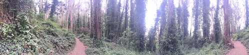
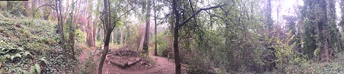
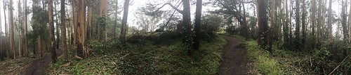
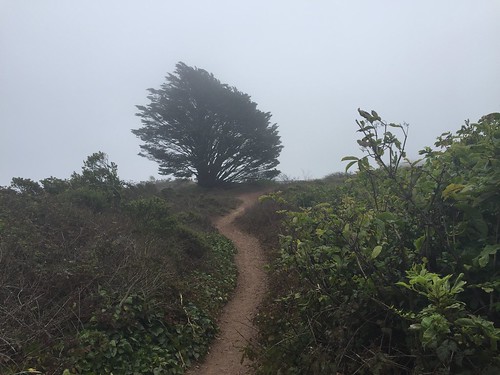
Take any map of San Francisco, and somewhere near the center there will be a green patch that’s either labeled “Mount Sutro Open Space Preserve,” or “Interior Greenbelt,” or some combination of the two. Whatever you want to call it, it’s a gorgeous man-made park — the non-native trees are a dead giveaway — with various trails zig-zagging around for hiking and mountain biking.
There’s several entrances, but I started at the one maintained by Parks and Rec at Stanyan near the end of 17th Street. There’s a small staircase and a sign to mark the entrance.
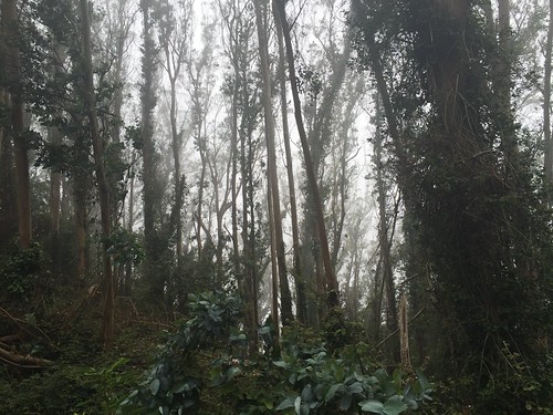
The hike up Mount Sutro is not one for the faint of heart — the trail is often steep, covered with rocks and fallen tree branches, and can be muddy and wet from the fog. At times it even felt like it was raining due to the fog rolling off the trees above.
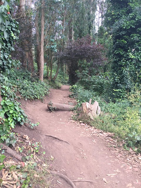
The park has a somewhat surreal feel to it; you know in your mind that you’re still in the city, but for the most part it doesn’t feel like it. Sure, you can see some houses from a few vantage points, or hear sirens in the distance, but there’s little evidence to suggest there’s a bustling city not far below.
To add to the strange feeling, the place was nearly deserted. I could probably count the number of other hikers I encountered on one hand. Some part of me kept expecting to find a group of teenagers drinking or smoking pot in the bushes, but I didn’t even see any litter to suggest that this was a place people had escaped to for such endeavors.
Which is all a fancy way of saying that this place is rather unique. You won’t find crowds of tourists here like Golden Gate Park or Telegraph Hill.
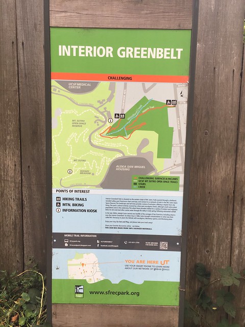
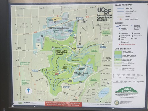
By the time I got to the top I was somewhat lost. There were no obvious vantage points to find my bearings thanks to the trees and the fog, and my phone wasn’t picking up enough of a signal to use Google Maps. Fortunately, UCSF was kind enough to put a map there right when I needed it.
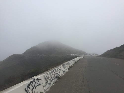
Following the map, I took the East Ridge Trail down to Aldea Housing. From there my phone briefly got a strong signal again. I thought about turning back, but figured what the hell — Sutro Tower wasn’t far away. Why not press on?
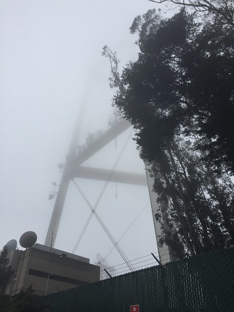
There’s no obvious signs leading you to Sutro Tower from there, and it was so foggy I couldn’t have even guessed which way to go to find it. Fortunately Google Maps had my back and a few minutes later I found what I can only assume is the base of the tower, prodding the underbelly of our dear friend Karl.
Following my gut, I walked around the reservoir next to Sutro Tower until I found another trail that seemed to be leading towards Twin Peaks. Once again this would have been much easier had I been able to see where I was going. (Million dollar idea: Glasses that let you see through fog. Get on it, hardware startup entrepreneurs!)
Fortunately an older couple heading in the opposite direction confirmed to me that I was on the right track.
After jumping a barrier and heading up a somewhat steep trail that didn’t seemed “official,” to put it mildly, I found a whole crowd of tourists. I’d done it! I’d made it to Twin Peaks!
The fun of Twin Peaks — if you’ve somehow never been — is not the view. In fact, there’s rarely much of a view at all. No, the fun is watching hoards of confused tourists scream about how they’re freezing, watching pamphlets get blown out of their hands by the wind, and seeing them take selfies against a backdrop of fog. It’s really a blast.
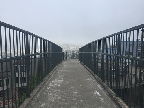
At this point several hours had passed and it was time to head back home. On the pedestrian/bike side of the recently reconfigured figure eight, I jumped another barrier and made my way down a staircase, followed by another, then another, then like maybe two or three more. Yeah, my knees are going to be sore as hell tomorrow.
But at least from here I more or less knew where I was going. If you’re walking to or from Twin Peaks from the Mission/Noe Valley, those stairs lead to a pedestrian overpass over Market Street, which is very handy for this particular part of the hike. The ramp on the other side takes you down to Grand View Ave. near the end of 23rd Street.
The fitness tracker says all in all that worked out to just over six miles, though if you follow in my footsteps your mileage may vary depending on your exact route. A word to the wise: bring water with you, appropriate shoes, and full-length pants to avoid poison ivy. You also might consider an umbrella if it’s super foggy.
Finally, here’s a few panoramic photos of the Mount Sutro hike. As with all the photos in this blog post you can click it for a larger view. Additionally, all of these photos are in a Flickr album.